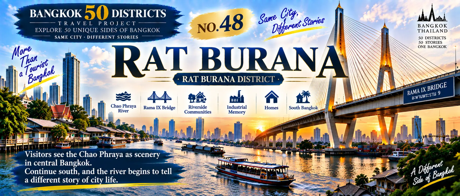
Leave Chom Thong
and continue toward the Chao Phraya River.
The city’s relationship with water begins to change again.
At the previous stop,
we followed canals into old communities.
At this stop,
the view opens up again.
Small canals begin connecting with a much larger body of water.
Roads approach the river.
Homes and communities stretch along the waterfront.
Large bridges cross the Chao Phraya.
Industrial and warehouse spaces
also preserve traces of South Bangkok’s development.
This is:
Rat Burana
For many visitors,
the Chao Phraya River means:
The Grand Palace.
Wat Arun.
ICONSIAM.
Riverside hotels.
Cruise boats.
But continue farther south,
and the same river reveals
a completely different urban landscape.
Here, the Chao Phraya is not only scenery—it is also a space for everyday life and urban development.
01|From Chom Thong into Rat Burana
Leave Chom Thong
and continue east toward the Chao Phraya River.
Chom Thong.
↓
South Bangkok.
↓
Rat Burana.
↓
Riverside Community.
↓
Chao Phraya River.
Canals are still present.
But the water begins to open up.
From small waterways running through communities,
we return to one of Bangkok’s most important rivers.
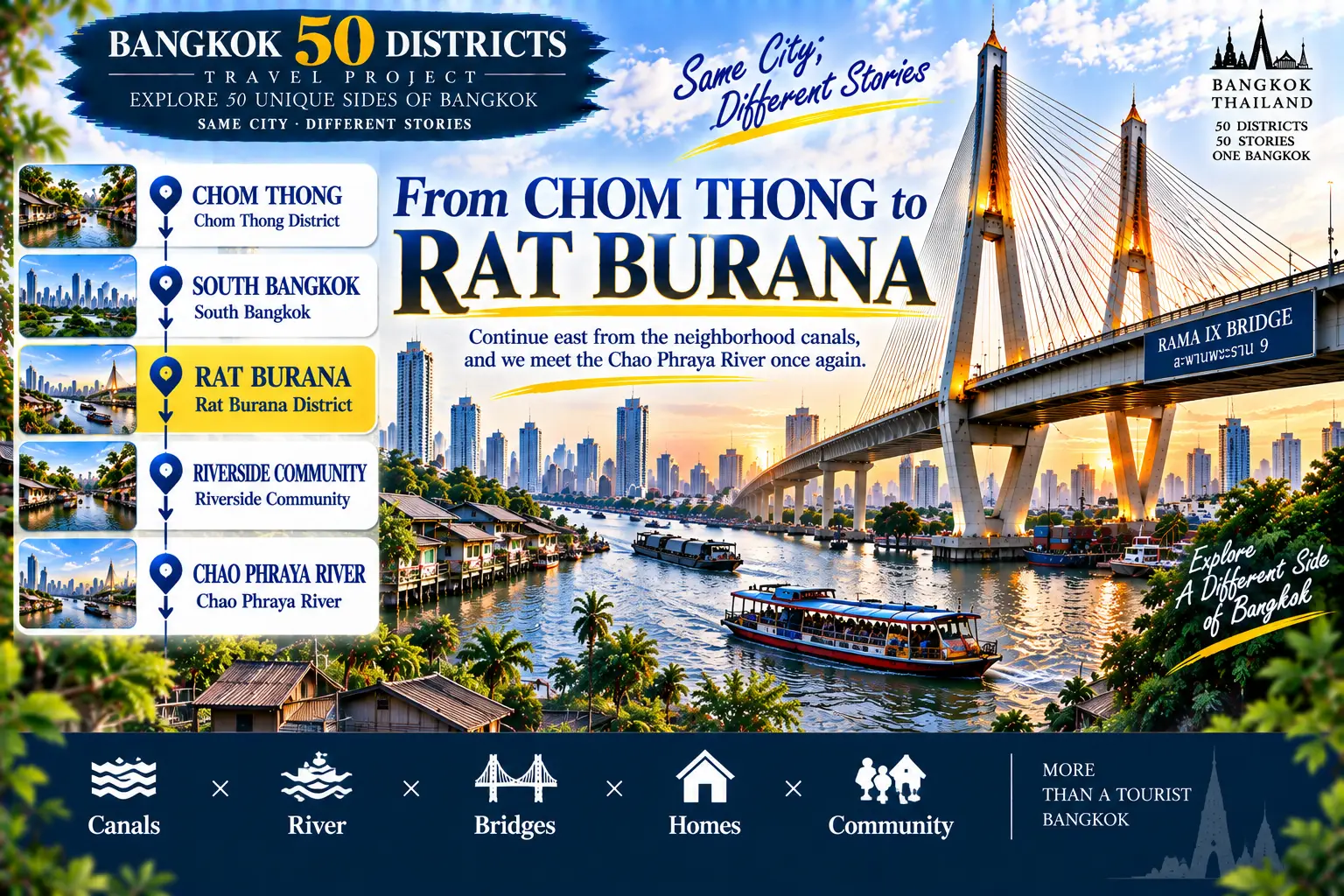
CHOM THONG
↓
SOUTH BANGKOK
↓
RAT BURANA
↓
RIVERSIDE COMMUNITY
↓
CHAO PHRAYA RIVER
CANALS × RIVER × BRIDGE × HOMES × COMMUNITY
**Continue east from the neighborhood canals,
and we meet the Chao Phraya River once again.**
02|The Chao Phraya Is More Than a Tourist View
For many first-time visitors,
the Chao Phraya means:
Temples.
Palaces.
Hotels.
Shopping malls.
Cruise boats.
Night views.
But as the river continues south,
its urban role begins to change.
Homes.
Piers.
Roads.
Warehouses.
Workplaces.
Local communities.
The same Chao Phraya River
connects very different versions of Bangkok.
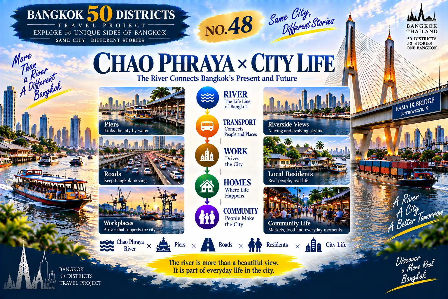
CHAO PHRAYA × CITY LIFE
RIVER
↓
TRANSPORT
↓
WORK
↓
HOMES
↓
COMMUNITY
CHAO PHRAYA × PIERS × ROADS × RESIDENTS × CITY LIFE
**The river is more than urban scenery.
It is part of everyday city life.**
03|Rama IX Bridge × City Connection
In this part of Bangkok,
large bridges across the river
become an important part of the landscape.
Bridges connect both sides of the city.
Cars cross the Chao Phraya.
Road networks continue toward southern Bangkok.
From a distance,
a bridge may look like
just another part of the skyline.
But from the perspective of how a city functions,
it represents:
Connection.
Transport.
Commuting.
Logistics.
Urban expansion.
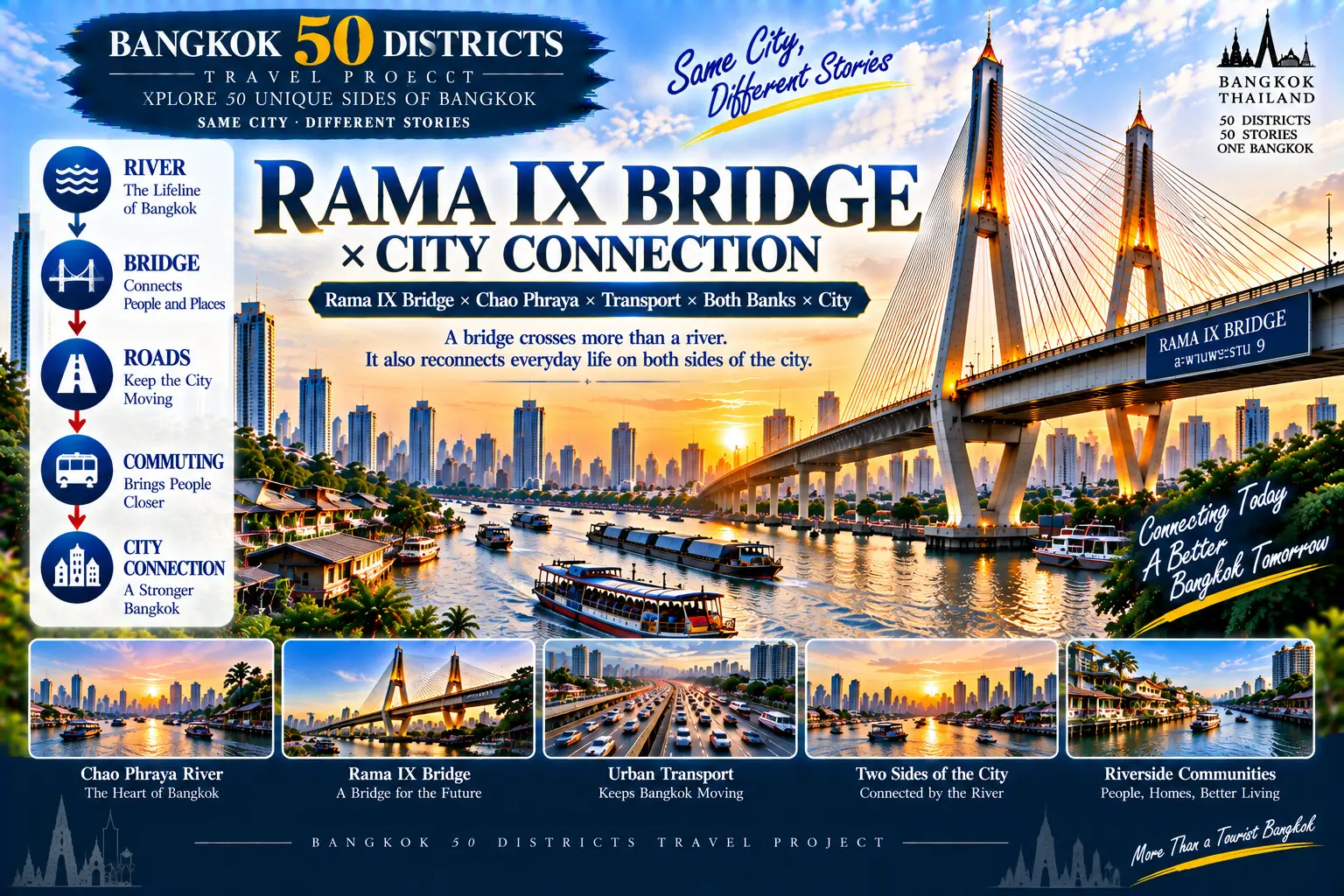
BRIDGE × CITY CONNECTION
RIVER
↓
BRIDGE
↓
ROADS
↓
COMMUTING
↓
CITY CONNECTION
RAMA IX BRIDGE × CHAO PHRAYA × TRANSPORT × BOTH BANKS × CITY
**A bridge crosses more than a river.
It reconnects everyday life on both sides of the city.**
04|Tourist River VS Working River
The same Chao Phraya River
can have completely different identities.
The side familiar to visitors:
Temples.
Cruise boats.
Hotels.
Shopping malls.
Night views.
Continue south:
Piers.
Roads.
Workspaces.
Homes.
Local communities.
One is a river designed to be seen.
The other is a river used every day.
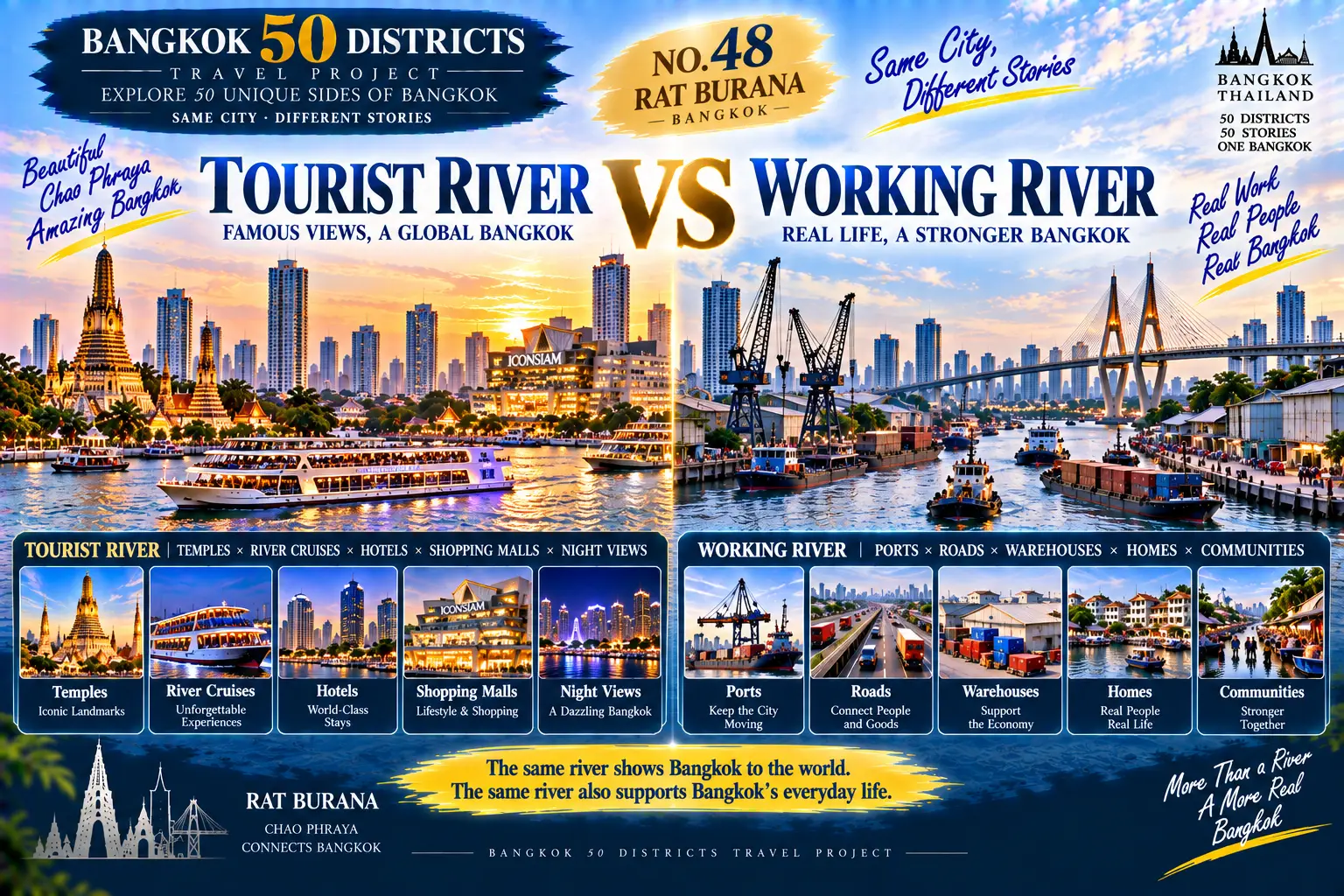
TOURIST × WORKING
TOURIST RIVER
TEMPLES × CRUISE BOATS × HOTELS × SHOPPING MALLS × NIGHT VIEWS
VS
WORKING RIVER
PIERS × ROADS × WAREHOUSES × HOMES × COMMUNITY
**One river presents Bangkok.
The same river also supports everyday life in Bangkok.**
05|Industrial Memory × Riverside City
Before modern road networks developed,
the river itself
was an important transportation route.
As a result,
many working and production spaces
naturally developed near the water.
Warehouses.
Piers.
Transport.
Factories.
Commerce.
These spaces helped shape
part of South Bangkok’s urban history.
Today,
the city continues to change,
and some industrial landscapes are changing with it.
But the riverfront still preserves:
The memory of how the city once worked along the water.
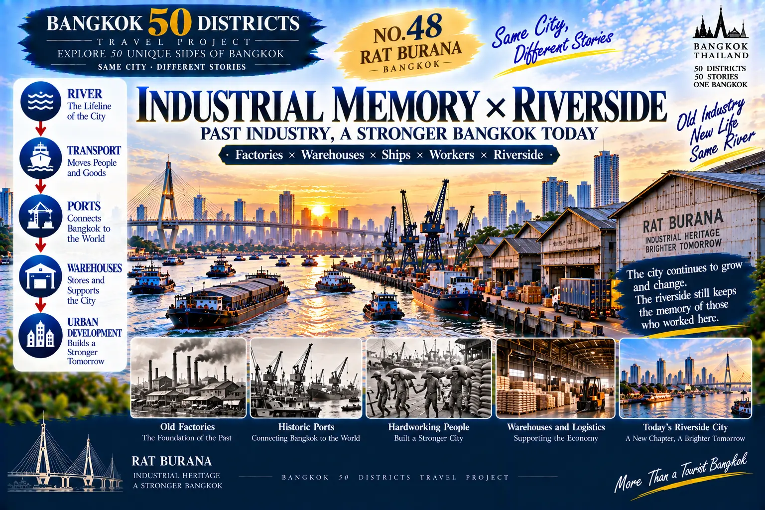
INDUSTRIAL MEMORY × RIVERSIDE
RIVER
↓
TRANSPORT
↓
PIERS
↓
WAREHOUSES
↓
URBAN DEVELOPMENT
FACTORIES × WAREHOUSES × BOATS × WORKERS × RIVERFRONT
**The city keeps changing.
The riverfront still preserves traces of its working past.**
06|Everyday Life in Rat Burana
A day here
does not revolve around tourists.
Morning:
Breakfast × Commute.
Noon:
Work × Lunch.
Afternoon:
Riverfront × Community.
Evening:
Bridge × Going Home.
For local residents,
the Chao Phraya River
is not necessarily a tourist attraction.
It may simply be:
The road home.
The background to work.
A river beside the neighborhood.
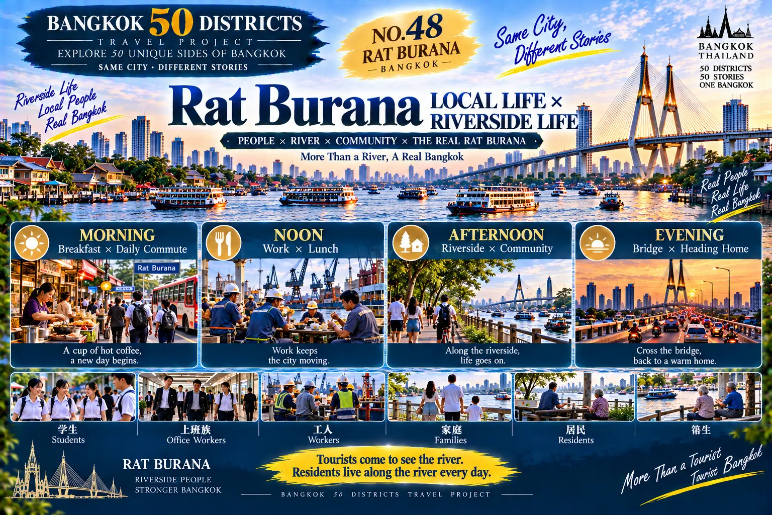
LOCAL LIFE × RIVERSIDE LIFE
MORNING|BREAKFAST × COMMUTE
↓
NOON|WORK × LUNCH
↓
AFTERNOON|RIVERFRONT × COMMUNITY
↓
EVENING|BRIDGE × GOING HOME
STUDENTS × COMMUTERS × WORKERS × FAMILIES × RESIDENTS
**Visitors come to see the river.
Residents live along it every day.**
07|Postcard Bangkok VS Everyday Riverside Bangkok
Bangkok in travel advertising
often looks spectacular.
Temples.
Night views.
Luxury hotels.
Cruise boats.
Skyscrapers.
But a complete city
also includes:
Ordinary homes.
Piers.
Markets.
Workplaces.
Roads.
Riverside communities.
These places may never appear on a postcard,
but they are equally part of Bangkok.
POSTCARD × EVERYDAY RIVERSIDE
POSTCARD
TEMPLES × NIGHT VIEWS × HOTELS × CRUISE BOATS × SKYLINE
VS
EVERYDAY
HOMES × PIERS × MARKETS × WORK × ROADS × COMMUNITY
**One Bangkok is made to be photographed.
Another Bangkok is simply lived every day.**
08|A One-Day Rat Burana Travel Plan
For this stop,
follow:
“Community → Riverfront → Bridge → Urban Memory”
and discover another side of the Chao Phraya River.
09:00|Depart Central Bangkok
Travel south.
10:00|Enter Rat Burana
Observe the urban landscape of South Bangkok.
10:30|Homes × Local Roads
Begin the day inside an ordinary neighborhood.
12:00|Local Lunch
Eat in an area used by local residents.
13:30|Chao Phraya × Riverside Community
Rediscover the river beyond the tourist route.
15:00|Industrial Memory × Workspaces
Observe the relationship between the riverfront and urban development.
16:30|Rama IX Bridge × Chao Phraya
See how the bridge connects both sides of the city.
18:00|Riverside × Evening
End the day beside the Chao Phraya.
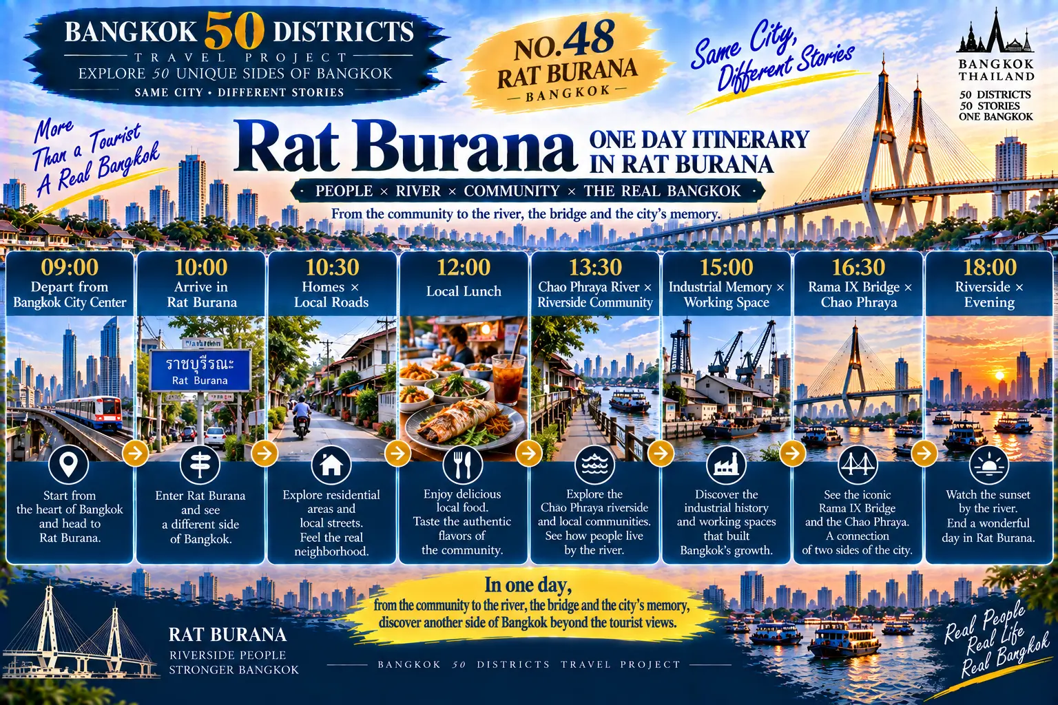
09:00|DEPART CENTRAL BANGKOK
10:00|ENTER RAT BURANA
10:30|HOMES × LOCAL ROADS
12:00|LOCAL LUNCH
13:30|CHAO PHRAYA × RIVERSIDE COMMUNITY
15:00|INDUSTRIAL MEMORY × WORKSPACES
16:30|RAMA IX BRIDGE × CHAO PHRAYA
18:00|RIVERSIDE × EVENING
**One day,
from neighborhoods to the riverfront, bridges and urban memory,
discovering another Bangkok beyond the Chao Phraya’s tourist scenery.**
09|Why Is Rat Burana Worth This Stop?
By District 48,
we have already encountered
many different forms of water.
Canals.
Waterways beside markets.
Mangroves.
Wetlands.
Coastlines.
The Gulf of Thailand.
Now,
we return to the Chao Phraya River.
But this time,
we are not returning
to the riverfront most familiar to visitors.
Instead,
we encounter:
The river beside ordinary homes.
The river beside workplaces.
The river beneath bridges.
The river seen every day by local communities.
And this changes the way
we understand the Chao Phraya.
The river does not belong only
to Bangkok’s tourism image.
It also belongs to:
Transport.
Work.
Homes.
Communities.
And the ordinary rhythm of everyday city life.
**Visitors see the Chao Phraya. Residents live along it.**
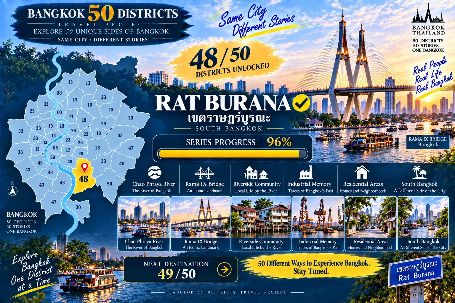
BANGKOK 50 DISTRICTS TRAVEL PROJECT
**48 / 50 UNLOCKED**
RAT BURANA ✓
SERIES PROGRESS|96%
CHAO PHRAYA RIVER × RAMA IX BRIDGE × RIVERSIDE COMMUNITIES × INDUSTRIAL MEMORY × HOMES × SOUTH BANGKOK
NEXT STOP: 49 / 50
**50 districts.
50 different ways of life.
Keep exploring Bangkok.**